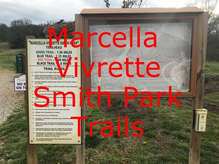
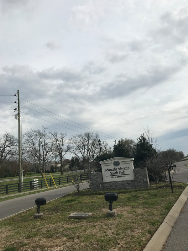
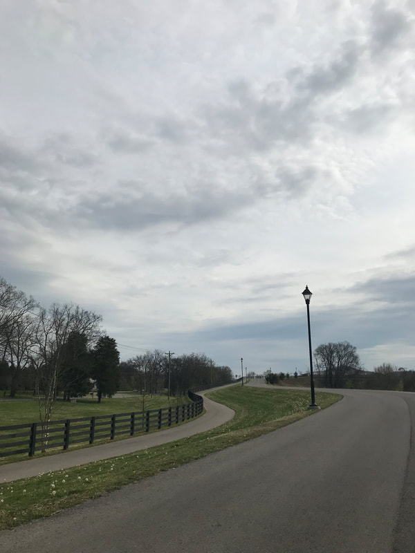
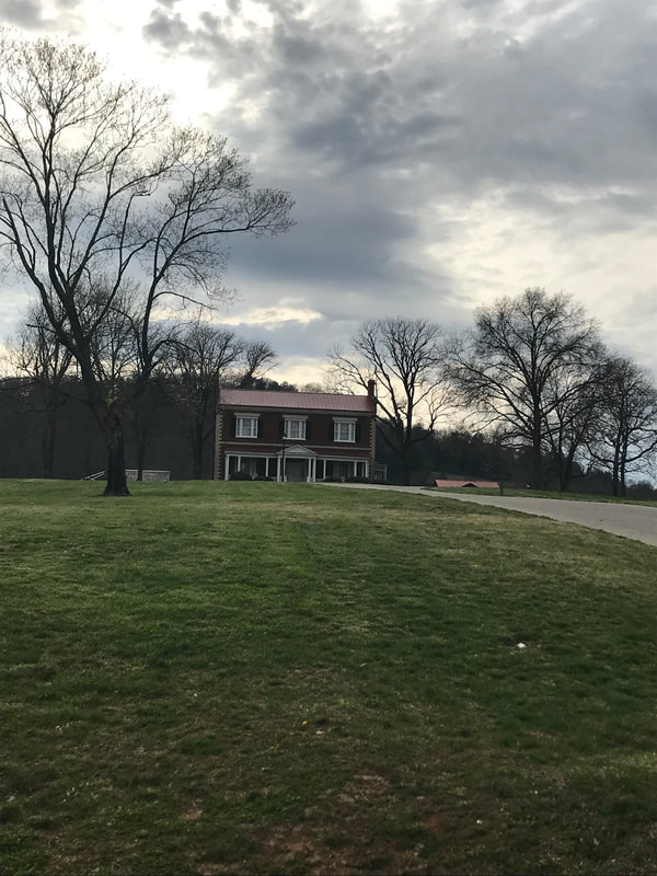
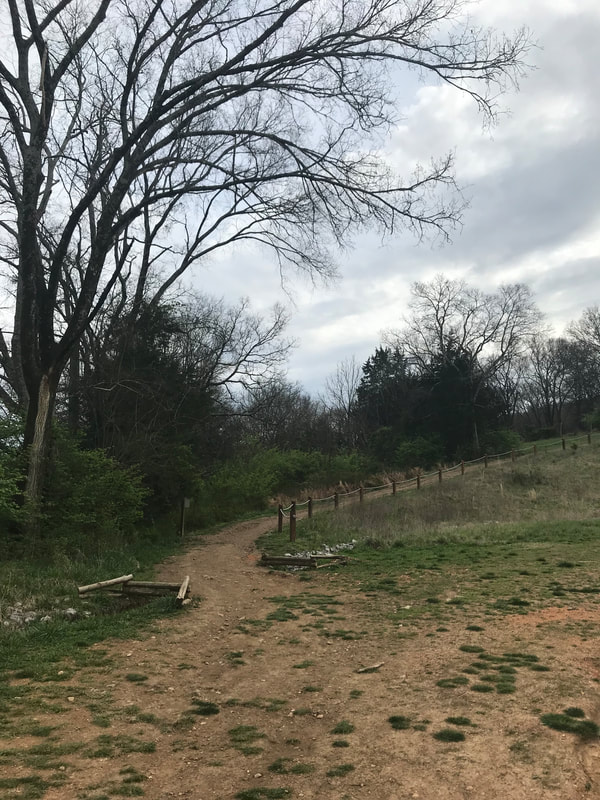
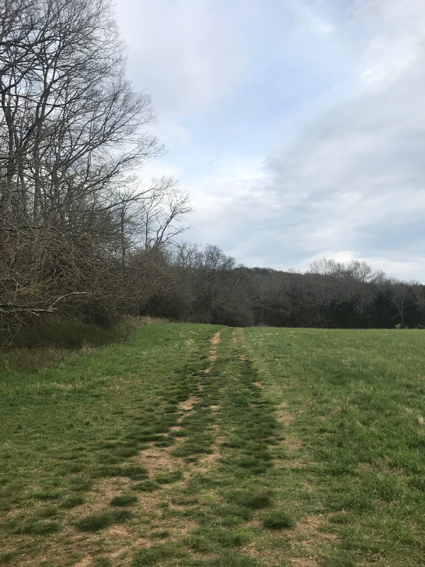
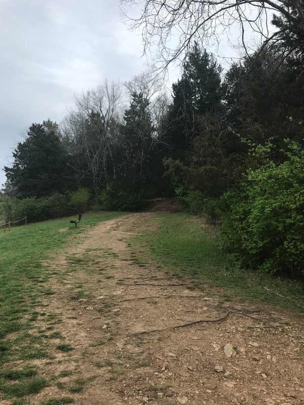
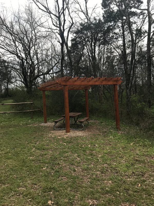
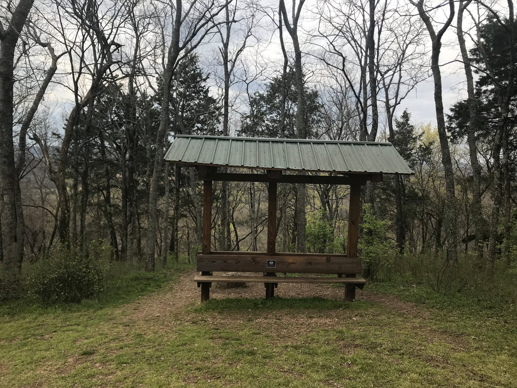
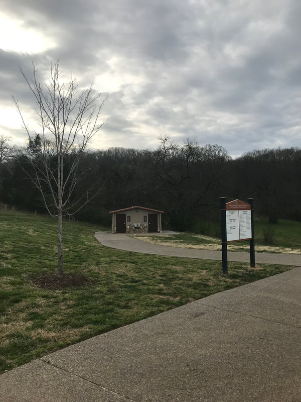
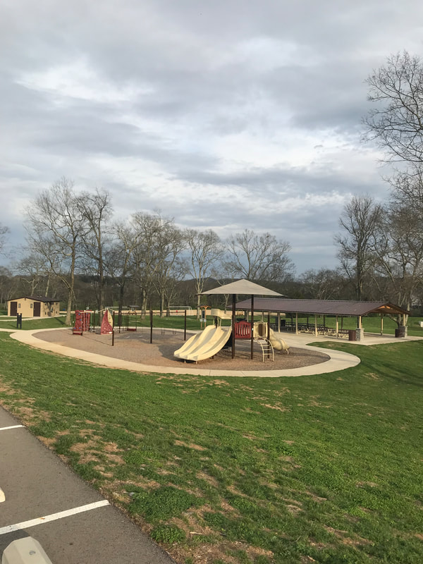
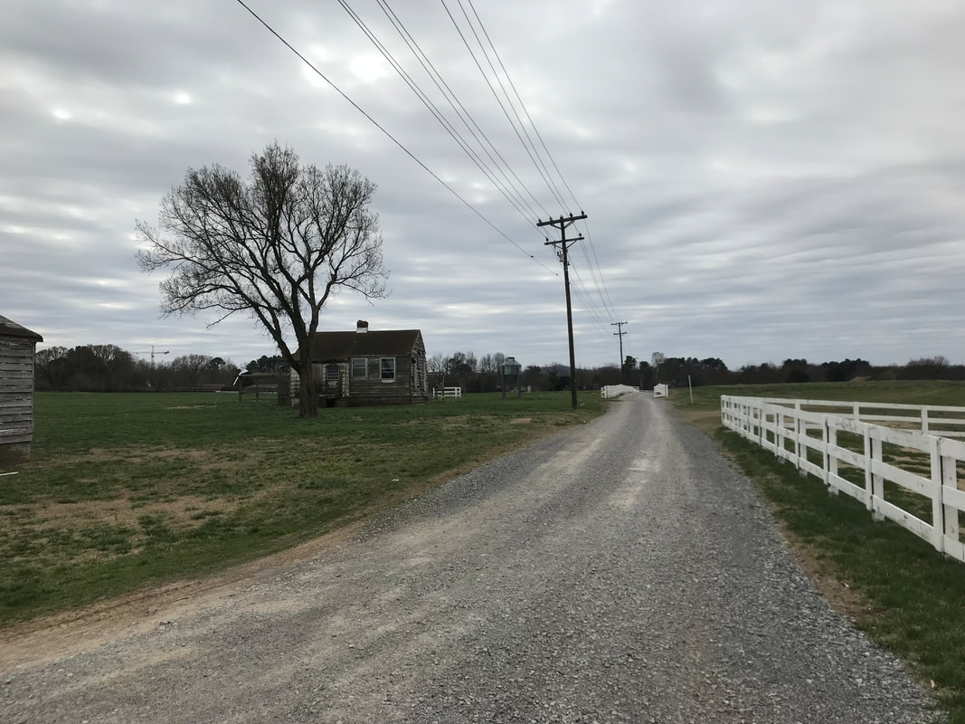
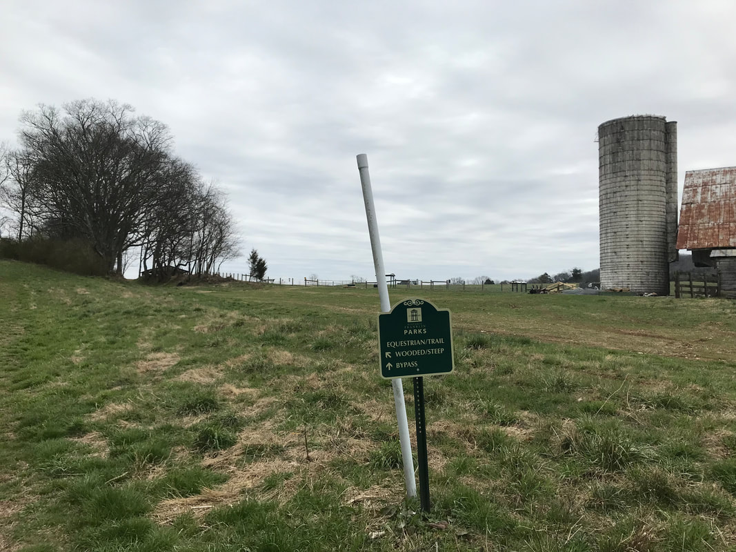
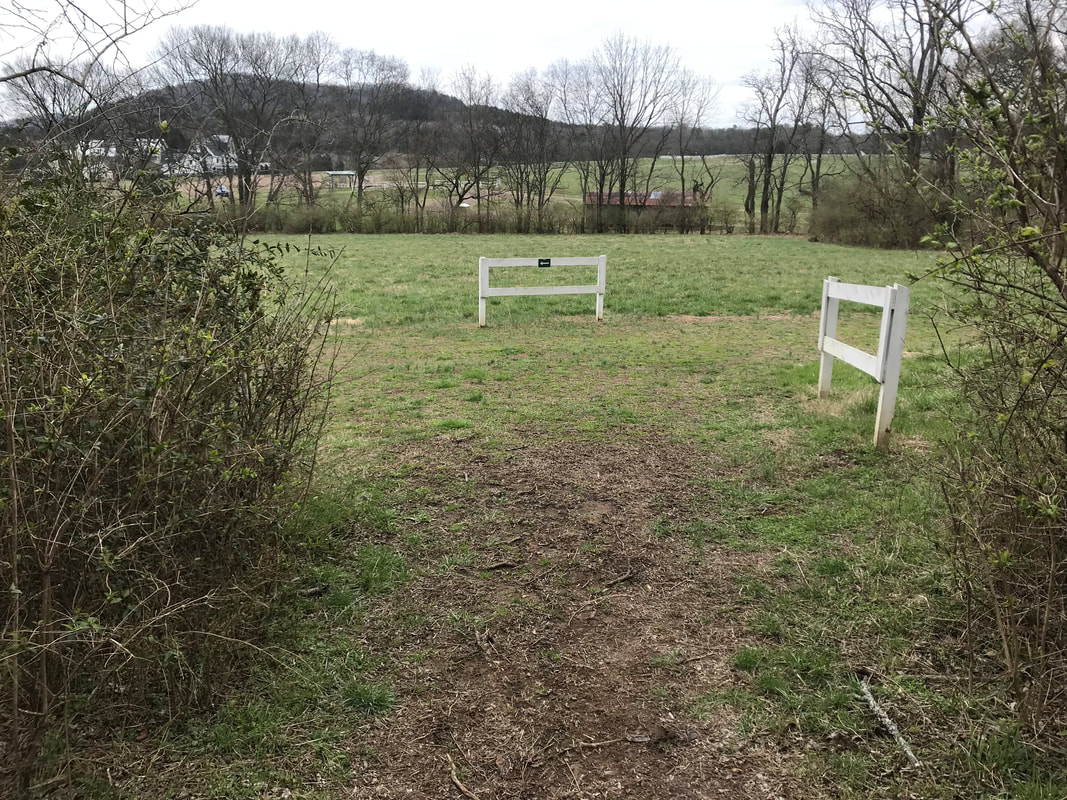
Out of all the parks, paths and trails in Williamson County, TN, this is the one I utilize the most! It is a beautiful park, the trails are wide (big enough to run alongside another person), well maintained, clearly defined and I just really enjoy it! There are 4 different paths that total 7.1 miles with something for everybody! You can choose to do a shorter, flatter trail or a longer, more intense one with a high elevation gain. Marcella Vivrette Smith Park is Brentwood's largest park at 400-acres. It is located at 1825 Wilson Pike, Brentwood, TN 37027. The property includes the beautiful Ravenswood Mansion - built in 1825, two multi-purpose athletic fields, restrooms, a picnic shelter, and a playground. It also connects to the Brentwood Parks Trail System so if you want to get in a really long training run that includes trails and paved paths, this is the place for you! If you wanted to stay within the park you could run on the road or the paved paths to add on a little extra mileage as well. As I said, plenty of options for everybody!
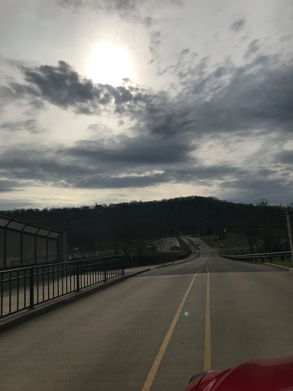
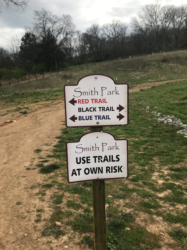
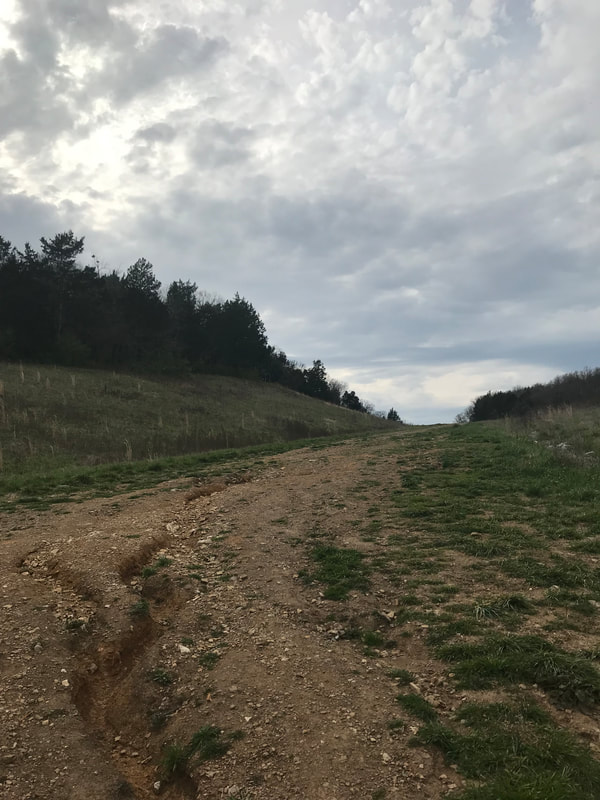
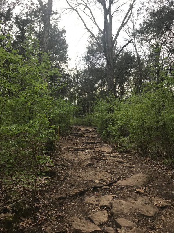
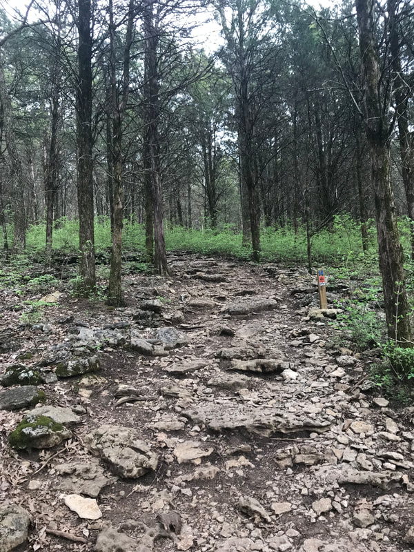
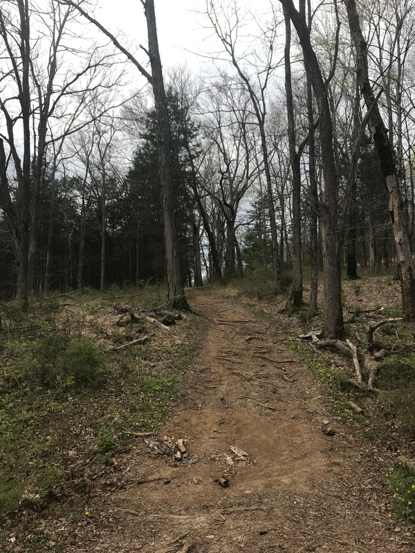
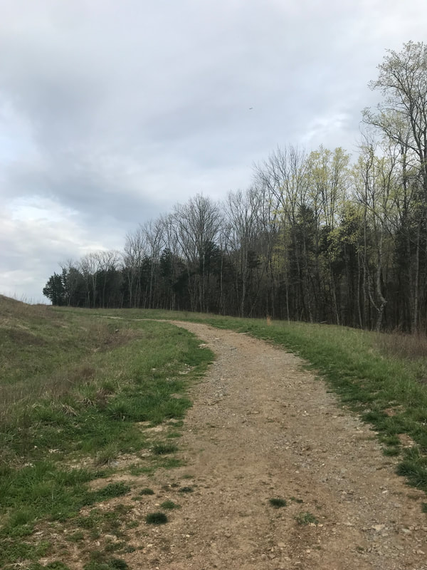
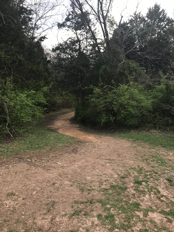
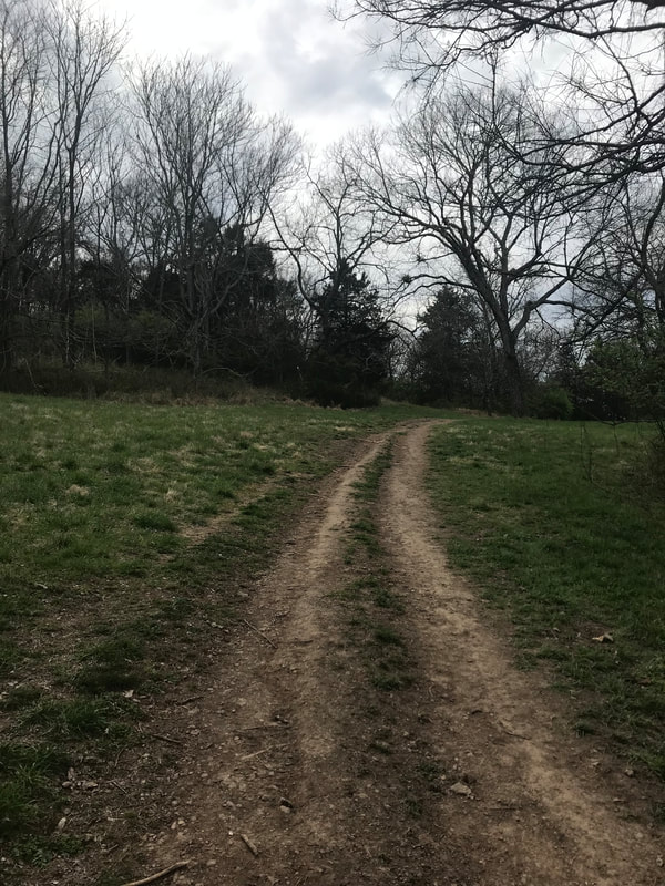
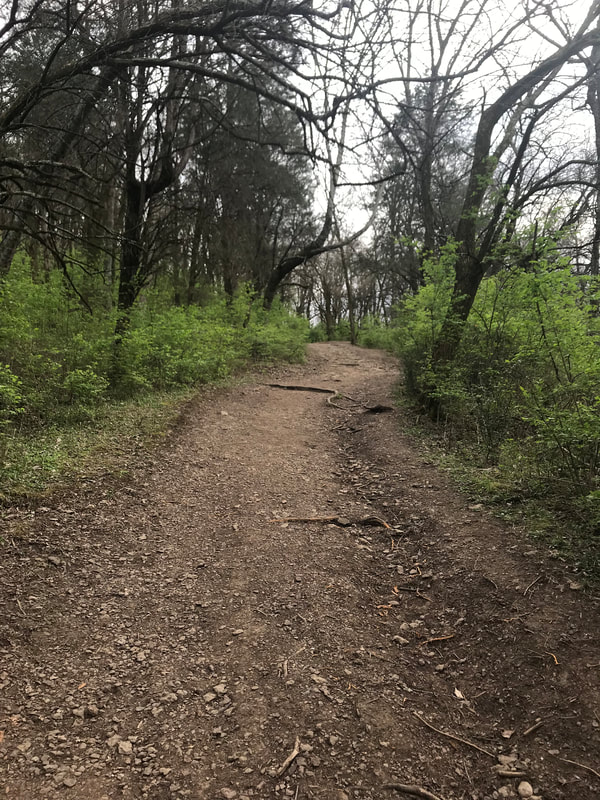
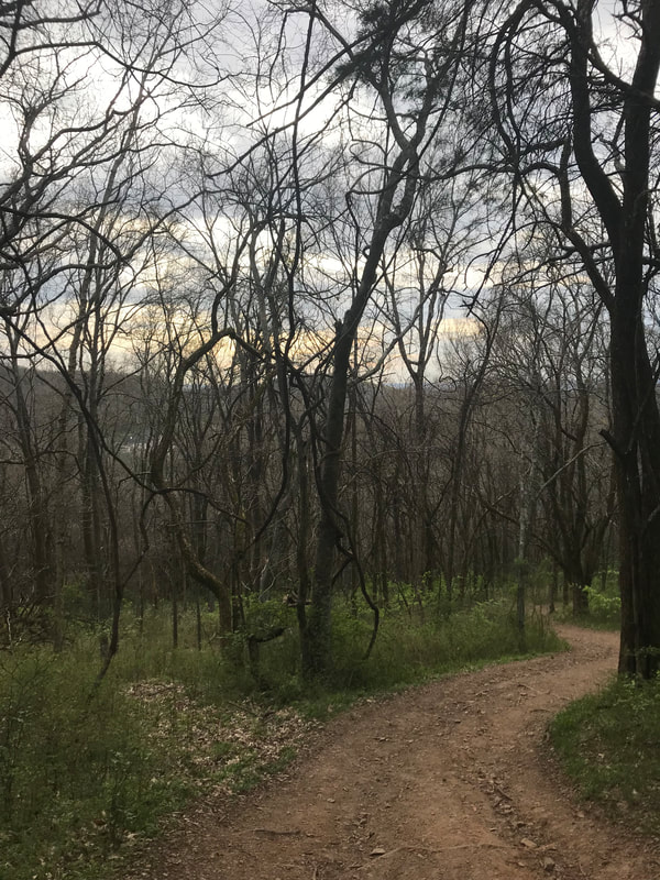
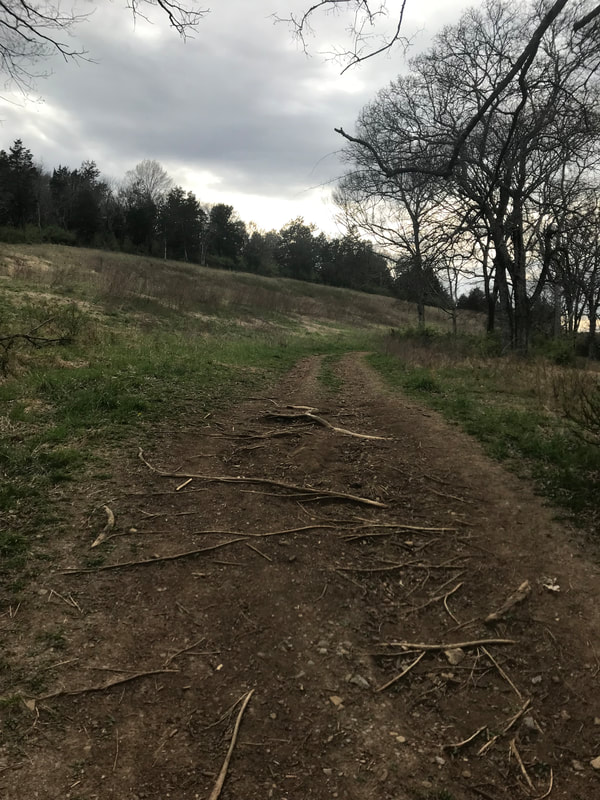
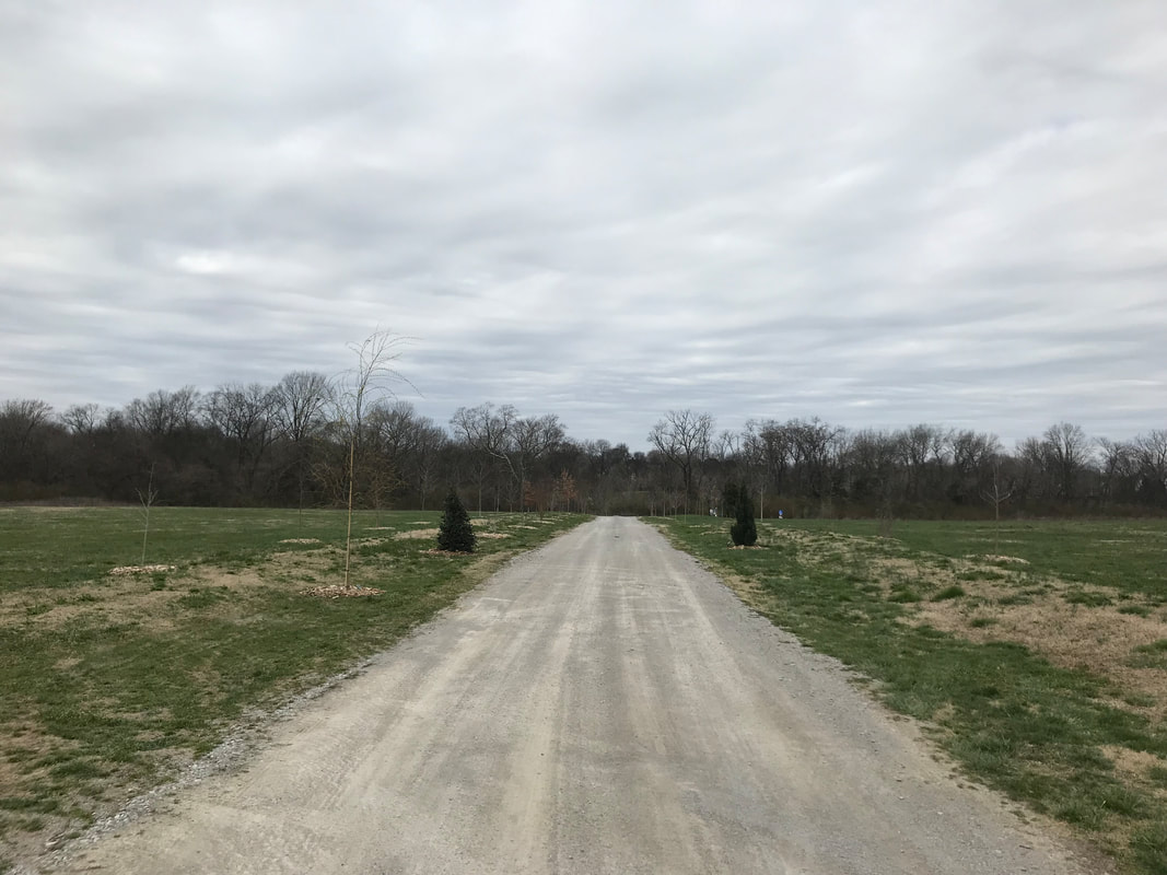
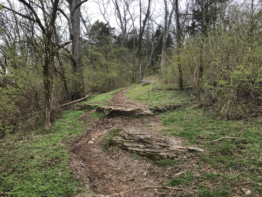
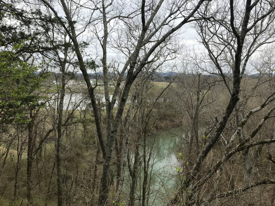
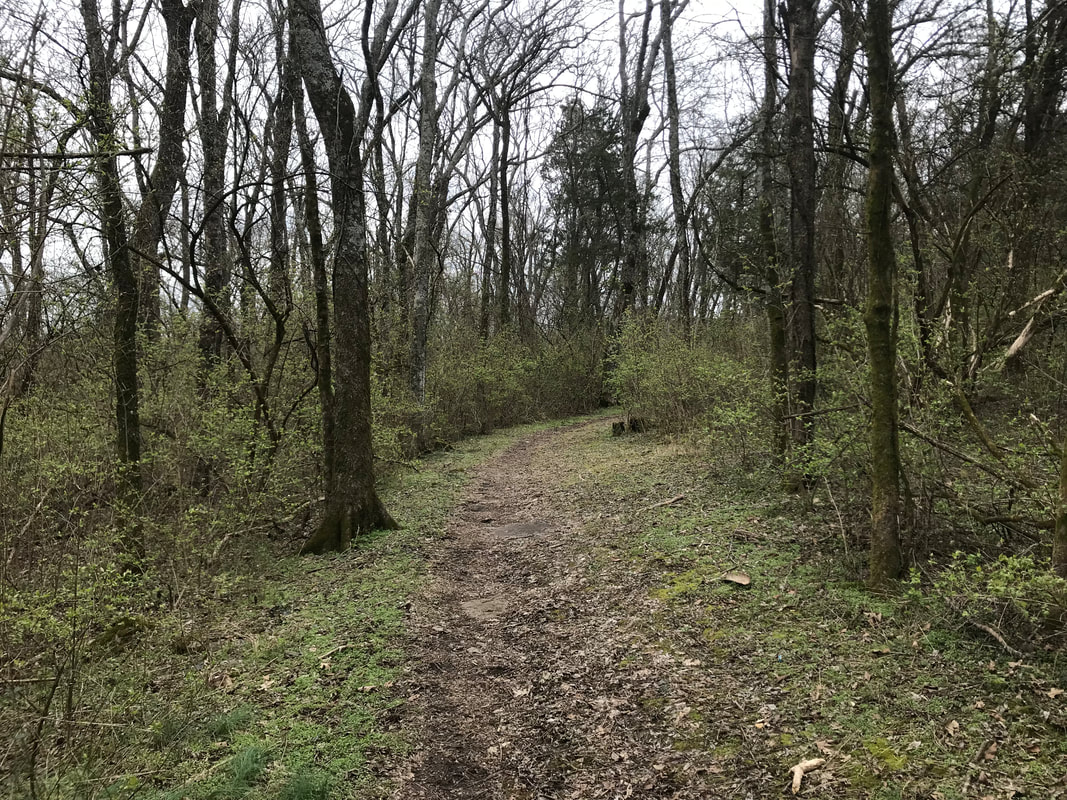
The park is open from dawn to dusk, so keep that in mind as they close the gates during the off-use time. When you come through the entrance you will drive down a long road and over a bridge (over train tracks) before you come to Ravenswood Mansion. You could park on the left side by the playground, fields, picnic shelter and bathrooms or drive further to the right and park by the entrance of the trails. There is a bathroom there, a water fountain, and a place to scrape off your muddy shoes. Speaking of shoes, if you plan on walking, hiking or running the trails you will want to wear the proper footwear - hiking or trail running shoes. There are some areas that can be a little slick, if it rains it definitely gets muddy and they will also help with the elevation gain and descent! If you select to do the more intense 5-mile trail (the one I have listed below that I normally do that utilizes all of the trails without really repeating anything - 520 ft elevation gain) you will begin at the Blue trailhead on the left and start a quick, uphill climb. Just for kicks, add in the Red trail and proceed to the top (this makes a little longer than a 1/2 mile climb from the start) before heading back down with a descent for a little over a 1/2 mile as you travel down Red and to the left on Blue through the woods until you reach a field. The back portion of the park on the Blue trail is pretty flat as you run through the rolling fields (be on the lookout for turkeys). You will then enter back into the woods and again just for kicks, head up the blue trail on a pretty steep climb over rocks, before heading back down to get on the Green trail. Through the woods you go as you travel up and down hills before coming to a bigger clearing with an open path that ultimately leads you back to the parking lot. You will travel up that path and then back down before coming back around to the Blue trail on your left. You will go into the woods and over a small creek before eventually turning on the Black trail loop before getting back on the Blue loop and heading to the parking lot. A majority of the trails are heavily wooded with a few portions of them through a field or on a wide open path. Be on the lookout for plenty of deer, turkeys, squirrels and birds (I even saw some sort of weasel once)! This is a great place to come on your own to enjoy the peacefulness or to bring your family and dogs! If you wanted the challenge you could even pack a picnic and work for it as you travel up the Blue and Red trail to the picnic shelters at the very top :) Also, I don't know why it is better here than other parks but during the summer there aren't as many spiderwebs clinging to your face as you run through the trails and you aren't rubbing against brush to have to really worry too much about ticks (huge bonus). The Trail Run Project and All Trails app lists all of the trails and can be used in helping you navigate when you are out there. You can also download the map here. As I always say though, the best way to experience these trails is to take your time and explore. Find the path that you enjoy the most or switch it up and have fun!!! I pulled this information from the City of Brentwood Marcella Vivrette Smith Park map on the individual trails so you can know more before you decide which one to do! Red Trail - 1.5 Miles (Difficult) Mostly uphill with one section that is very step. At the top it opens up to a nice level scenic overlook area. Great views in the fall & winter. Blue Trail– 2.25 Miles (Easy - Moderate - Difficult) This trail is the longest in the system. It consists of uphill sections and flat sections. Great views throughout. Wildlife can be seen frequently on this trail. Black Trail - 2.0 Miles (Easy - Difficult) Heart of the trail system. Trail stays within mainly wooded areas. Can be a little rocky at points. Wildlife is abundant on the trail. Green Trail - 1.36 Miles (Easy) This is the easiest trail in the park. Consists mostly of flat areas with awesome view of pastures. This section also has a great view of old slave walls. Find more paths, trails and places to hike/run/walk in Williamson County, TN here! 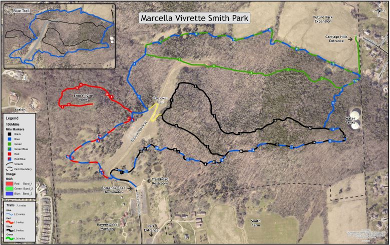
1 Comment
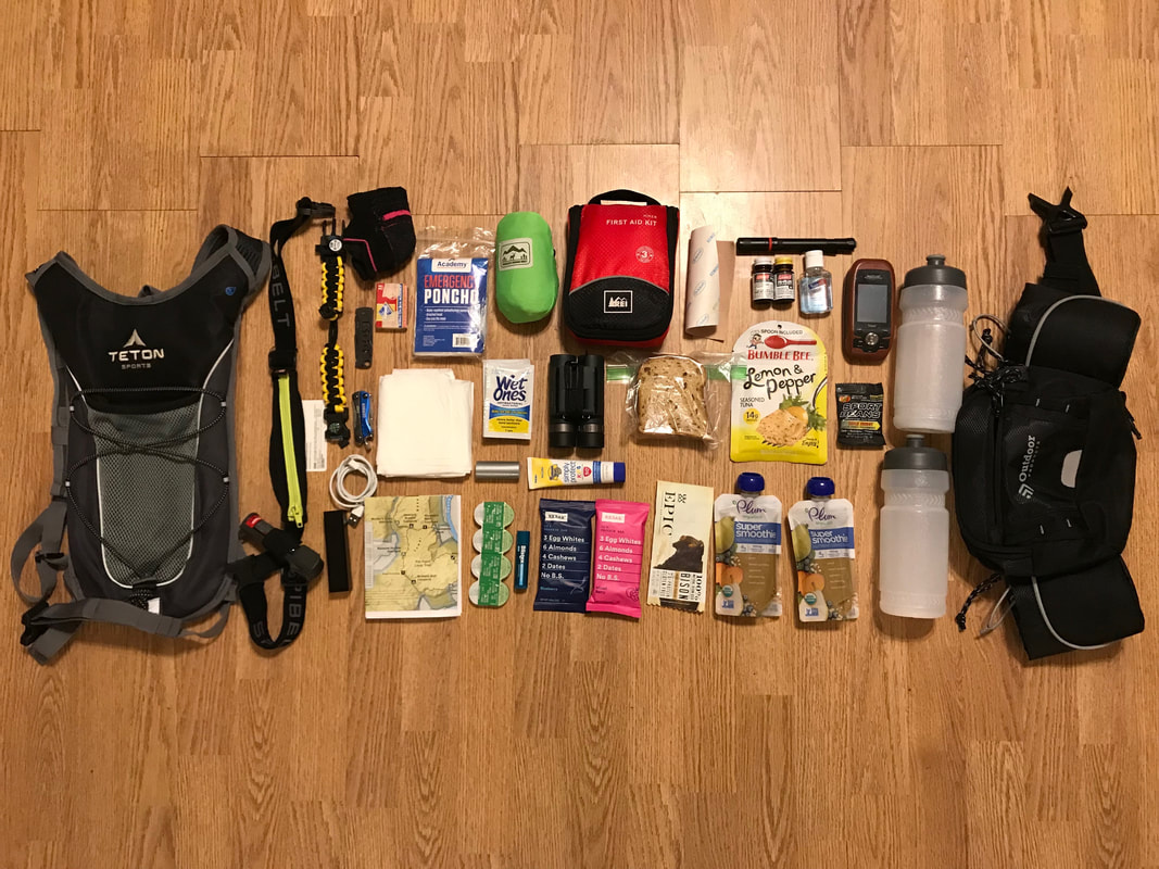 Months ago, I decided that for my 30th birthday I wanted to spend the day hiking with my husband. I knew I wanted to do a loop hike with a decent elevation gain that would take several hours to complete. After a lot of research between the both of us, we decided on the Cumberland Trail - Pot Point Loop (listed on the AllTrails app at 11.2 miles with a 1,387 ft. elevation gain). That allowed us to stay in Dunlap, TN at the cutest Airbnb farm with the option to go to Chattanooga if it rained. The reviews of the trail on AllTrails showed that we might be hiking more than the 11.2 miles (with an average of 30 minute miles) so I decided to plan for 13 miles just in case. The full hike ended up being 12.7 miles with an average of 28:57 min/mile with a moving time of 6:07:40 and an elevation gain of 1,821 ft. We weren't in a hurry, stopped for lunch to enjoy the view and did end up getting off course a few times (never very far though). I recommend before you decide to go on a hike that you honestly evaluate yourself to make sure you have the proper physical, mental and outdoor skills as well as the right gear. The list below is my recommendation of what to bring on a longer day hike. The food and water were specific to me, hiking 13 miles on a beautiful, sunny, 50-74 degree day in the mountains/hills. I based my water consumption off of 2 cups, or about 1/2 liter for every 1 hour of hiking. Hot or humid conditions, direct sunlight, high elevation gain, intense sweat rate and heavy pack weight are all factors that lead you to need more water, so you might do better with 4 cups or 1 liter an hour depending on the conditions. I tried to drink 1-2 big gulps every 15-20 minutes or so. As for my food, I had a large breakfast of 1/2 cup oatmeal with 1 cup almond milk, 1 Tbsp peanut butter, 1 banana and 2 Tbsp flax seeds. I then packed to have about 200 calories or so every hour with a 400 calorie lunch. It looked something like this - fruit pack, Rxbar, gluten-free bread with tuna and some jelly beans, fruit pack, Rxbar. I also had an Epic Bison Cranberry Bar just in case, but I didn't eat it. When we got home we kept drinking water and then refueled with some chips and salsa, clam chowder and gluten-free pepperoni mushroom pizza. We also had some wine and dairy-free ice cream. That might sound a little more indulgent than necessary after the hike BUT it was for my birthday and those were the treats I wanted throughout the rest of the night :) Okay, on to hiking gear! What to Bring on a Hike (What I Wore)
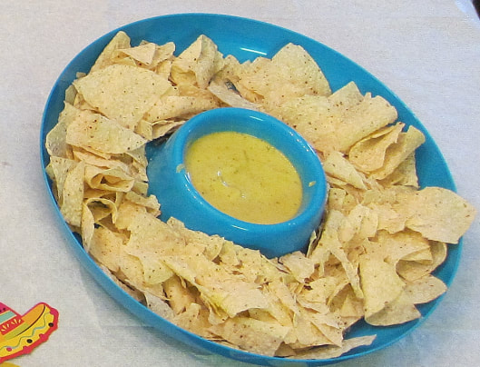
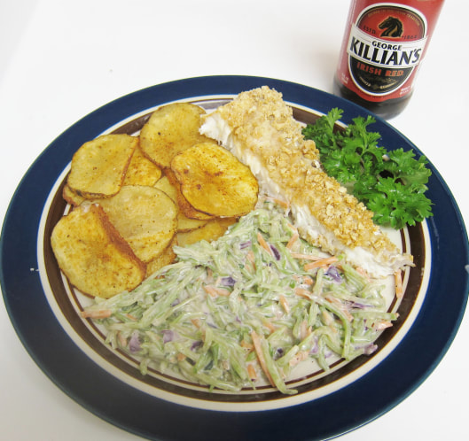
It is better to be safe than sorry, so over packing is better than under packing. That goes for gear, food and water. I used the AllTrails app for the trail map and to record our route and it saved us from going off course a few times. I highly recommend using that! We also had the regular GPS just in case but the phone was great for what we were doing. I was thankful for having the cell phone bank to charge my phone on the go towards the end though! We drank almost all of our water, ate all of the food (except the Epic Bars), used the hand sanitizer, chapstick and binoculars and the rest was all for good measure! I was thankful we had everything with us just in case, but even more thankful we didn't have to use it. Josh ended up carrying the large first aid kit, binoculars and GPS and I packed a smaller kit and used the GPS on my phone. Other than that, we both had the same supplies in case we got split up (which we made sure wouldn't happen). We also told a few people were we were going, what time we started and what time we expected to be back and signed the trailhead book with our names and start/end time - again, just in case! It is always important for at least one other person to know where you are going. Err on the side of caution, be prepared, start earlier than you think you should, pack more than enough food, water and gear and most importantly, enjoy your wonderful hike!!!!! 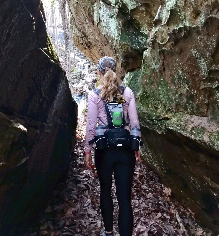 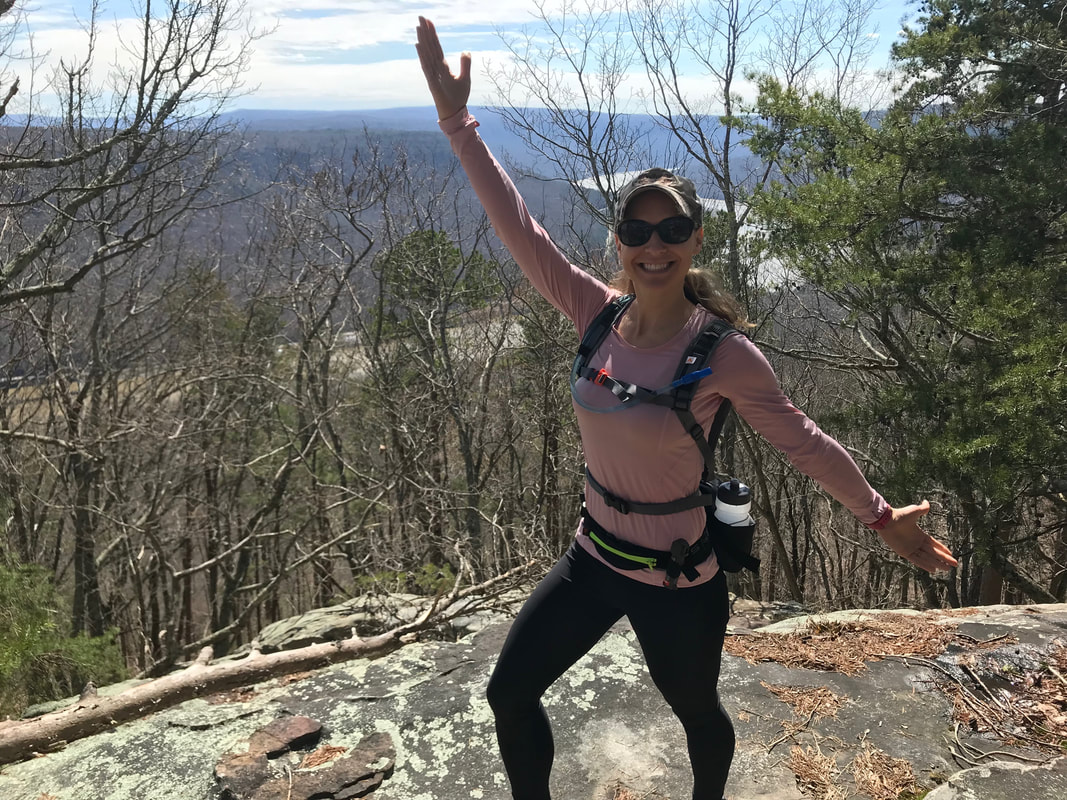  I love celebrating St. Patrick's day. I think part of it is because I'm Irish and it falls about a week after my birthday, so I usually end up doing some sort of combo St. Patrick's Day/Birthday celebration. I like to make Irish food while listening to Irish music and drinking some sort of Irish beverage (or just playing up anything green). This year is a little different because I am in Texas with my family but we are still celebrating by having friends come over and eating Irish (and/or green) food and having some drinks. If you are hosting a party, going to one or just want to make festive food at home while still eating healthy, look no further! Try out these delicious green recipes this weekend and get in the spirit! Bonus: They are also all gluten-free and dairy-free! Like these recipes? Check out more of my recipes and meal plans + thousands of others with the Prepear app! 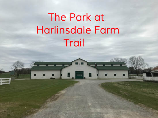
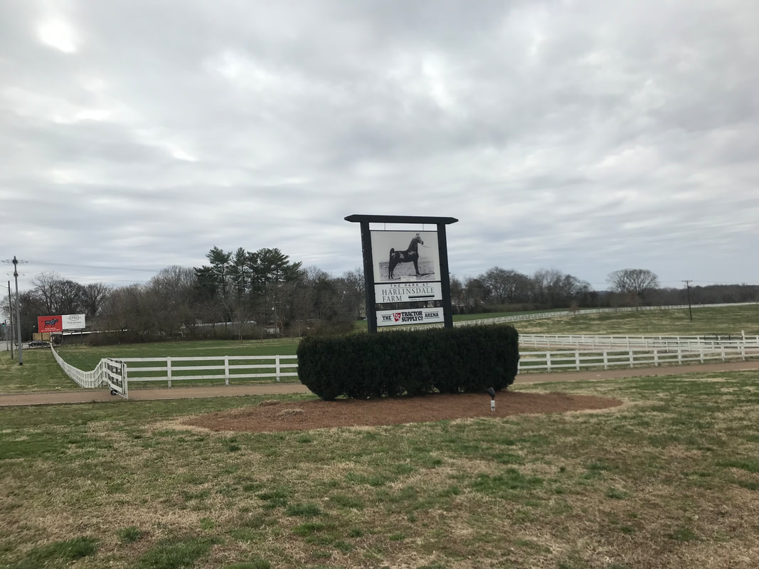
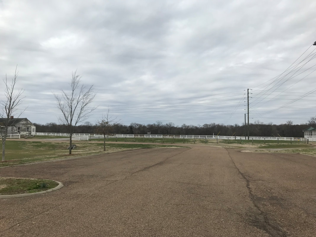
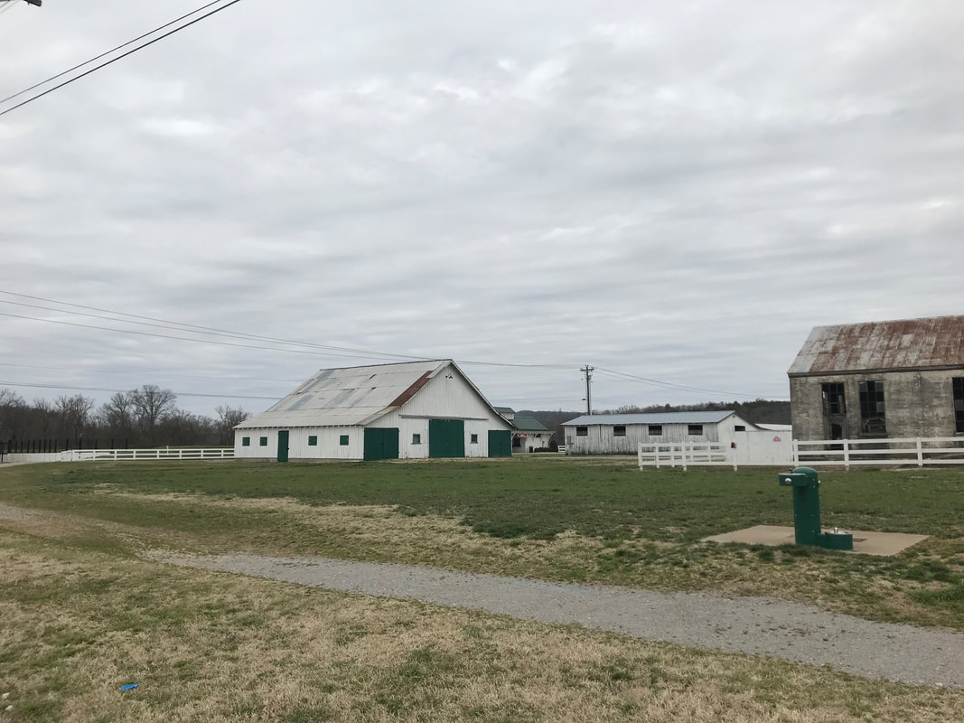
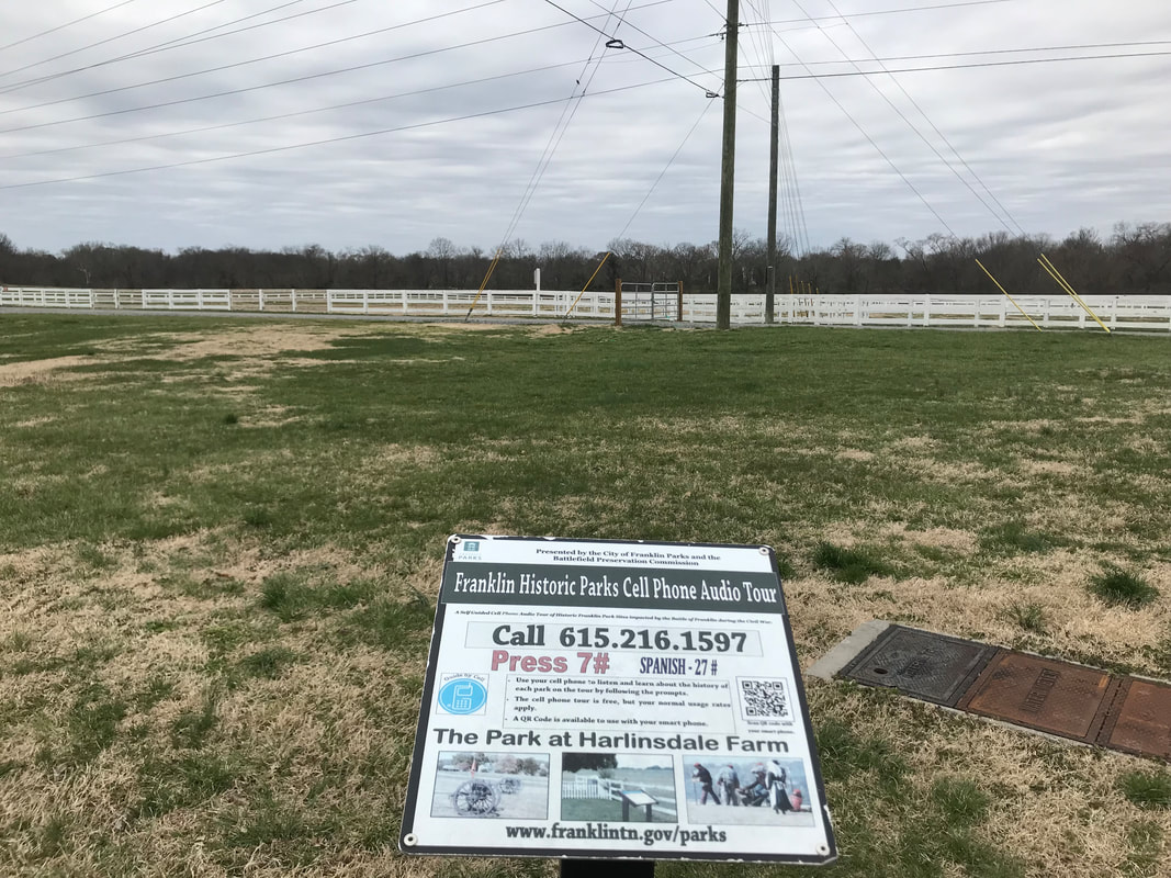
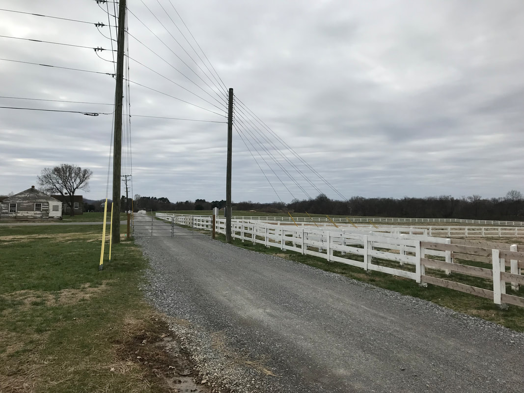
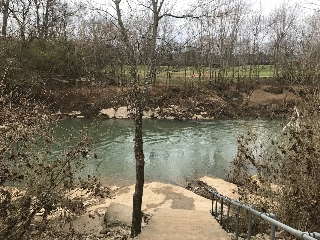
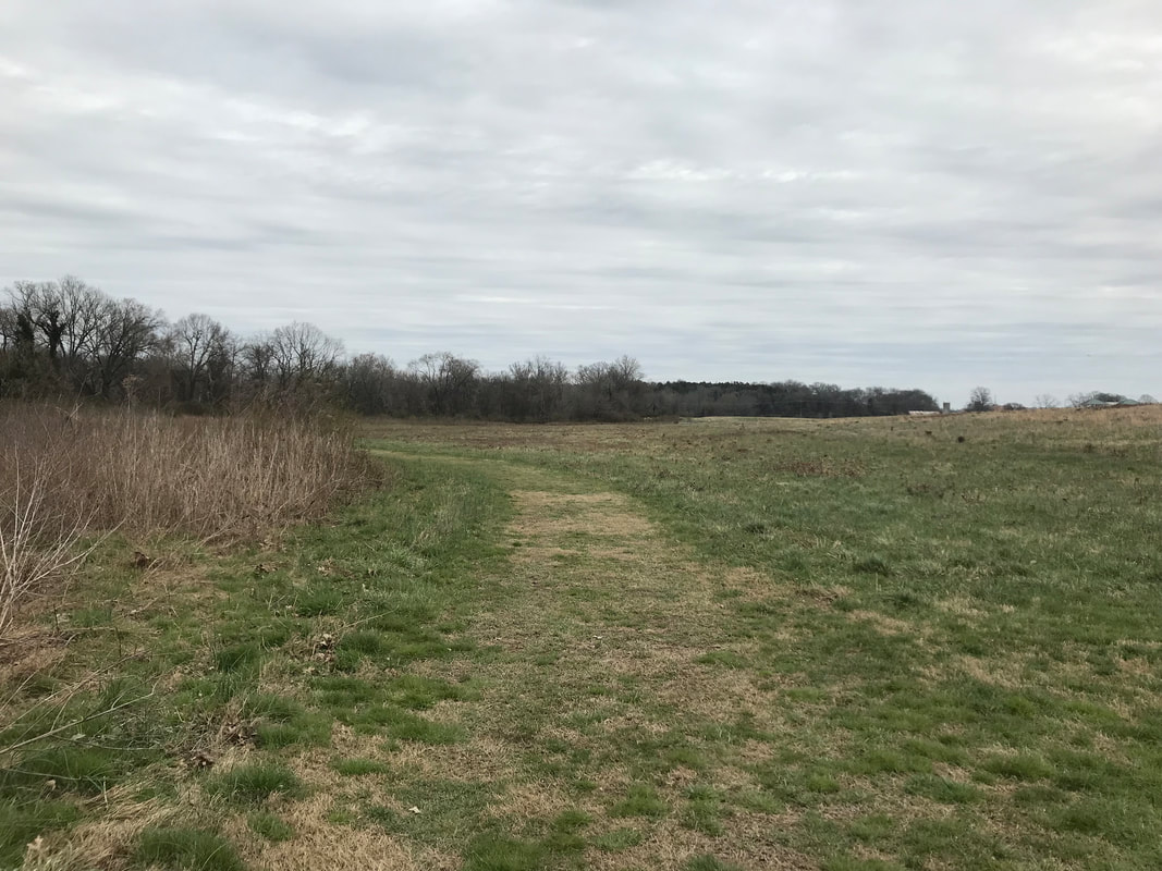
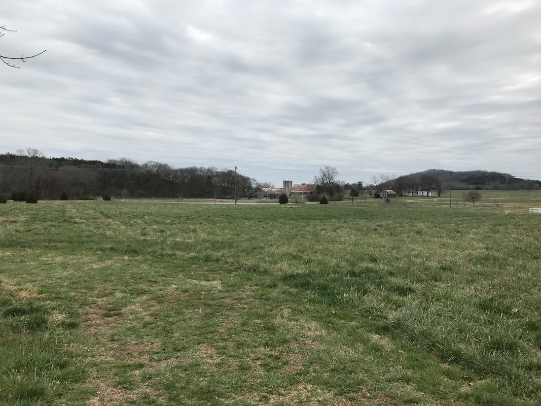
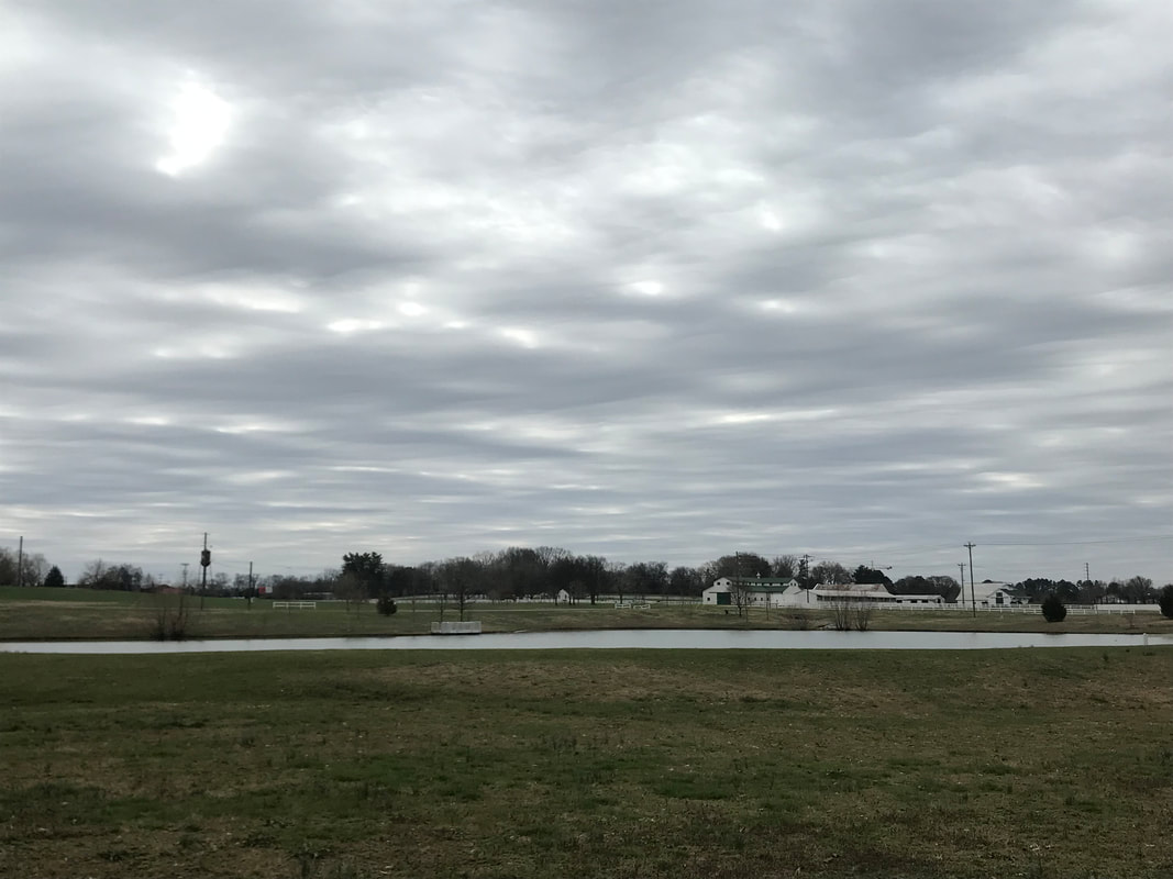
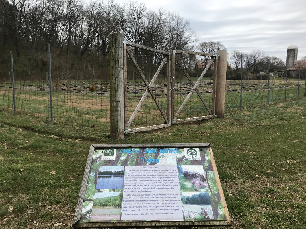
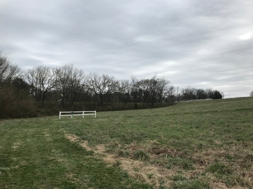
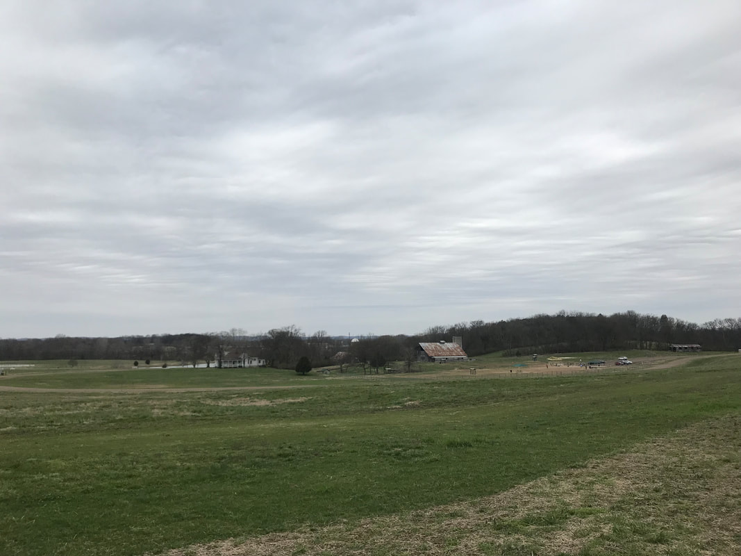
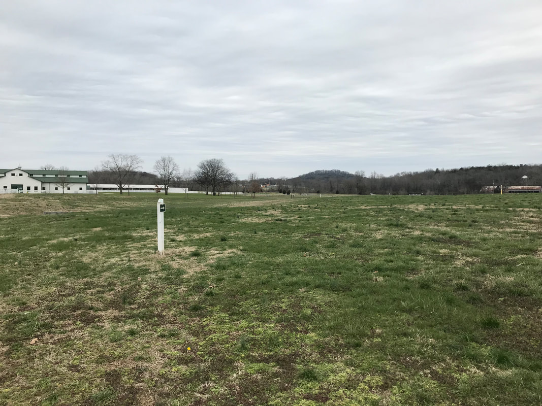
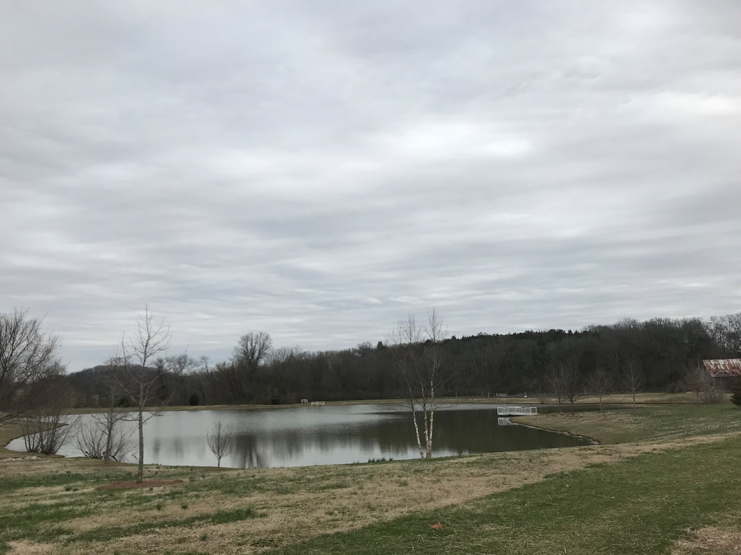
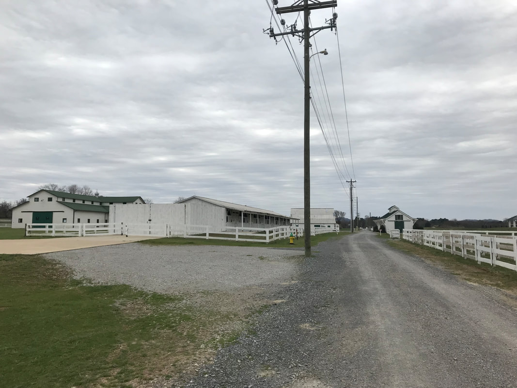
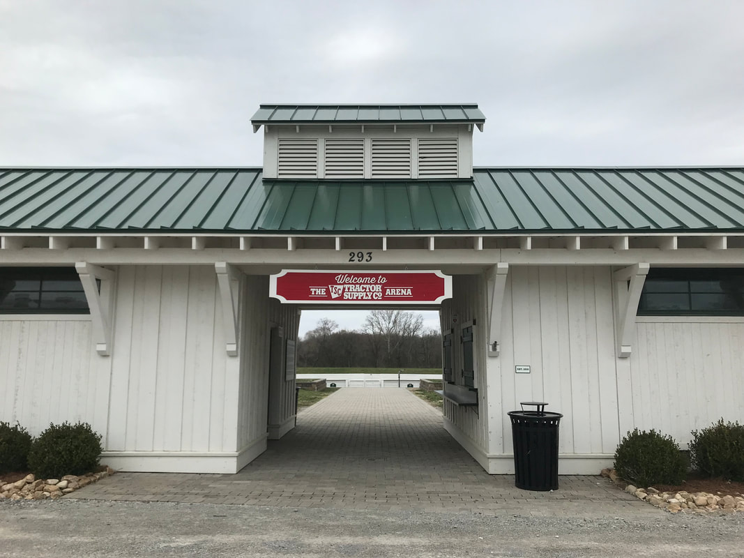
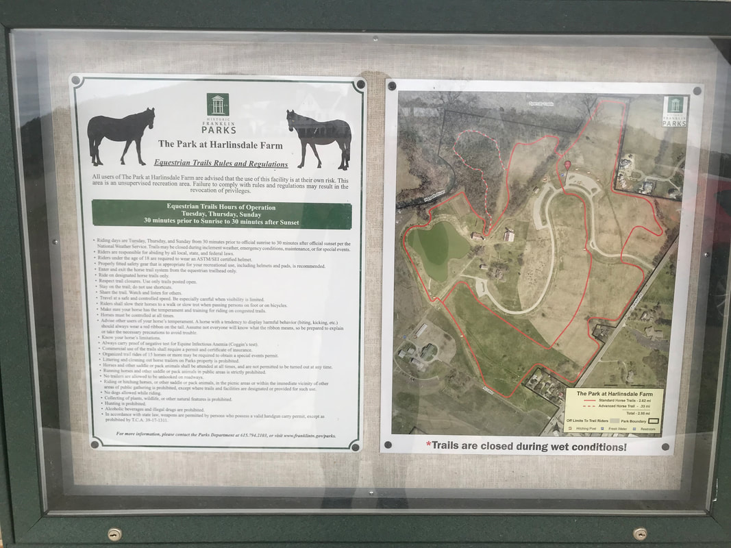
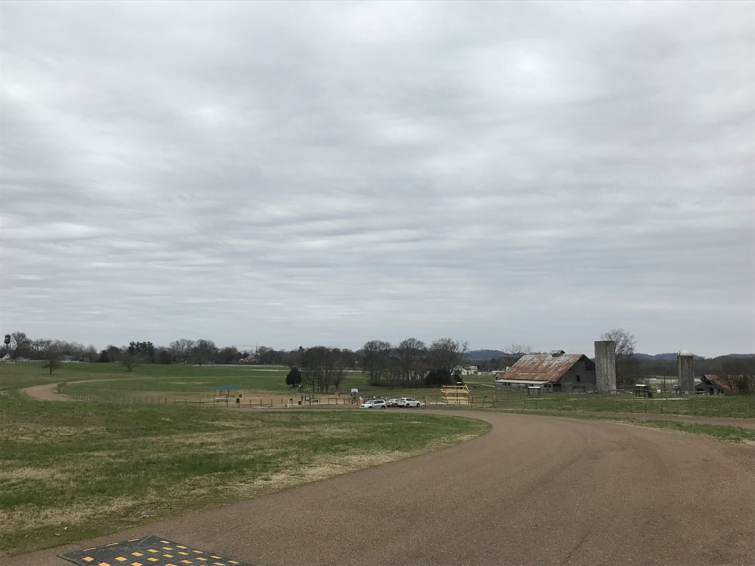
If you are looking for a unique park to run, walk and play with your kids and/or dogs, this is it! The Park at Harlinsdale Farm is a historic treasure right across from The Factory and near downtown Franklin. The 200-acre property of rolling farmland was a working horse farm for 7 decades before eventually being turned into a passive park. It has kept its open spaces, plenty of areas for picnicking and throwing frisbees or flying kites, a canoe launch to the Harpeth River, 3-acre pond with catch and release fishing (fishing license required), 4-acre dog park, an arena area, plenty of space to ride horses and my favorite - miles of trails! The park even hosts polo matches, concerts, festivals and 4th of July fireworks!
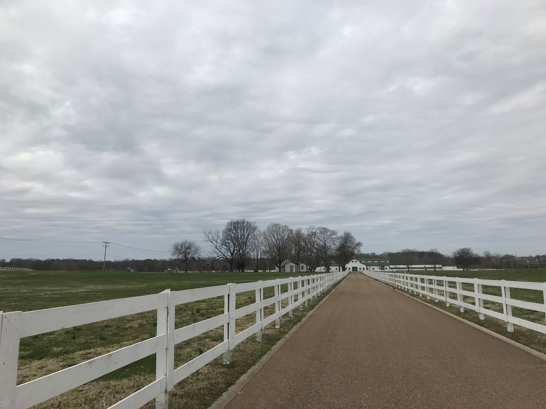
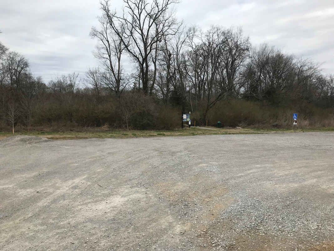
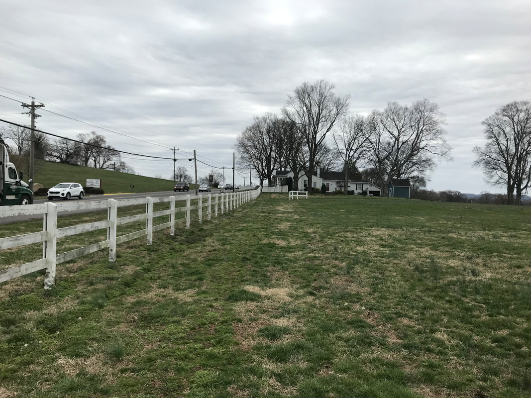
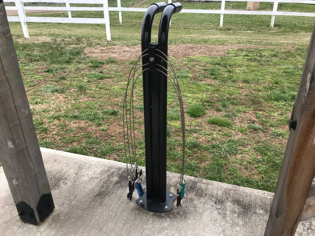
The park is located at 239 Franklin Rd, Franklin, TN 37064. There is a South entrance (directly across from The Factory) that takes you to the main entrance where the barn and arenas are. There is plenty of parking and a water fountain for you and your dog. If you keep driving down the gravel road on the left you will get to the canoe launch. The North entrance is a little further up Franklin road and will take you to another large parking lot and to the dog park. There is also a porta potty, potable water source, and an area to park trailers. The majority of the trails are turf/grass with a tiny portion going up into the wooded trails to an overlook and you can even include some of the park roads, depending on how much mileage you are looking for. You can get about 5.25 miles without repeating anything. There is a total ascent of about 194 ft and is mainly rolling fields except for the short, steep trail to the overlook. If you just want the turf/grass and wooded trail, stick to the first 3 miles. This is similar to the path (opposite direction though) that the free Walk Across Williamson Trail 5k normally follows. The park will eventually connect to downtown Franklin by a sidewalk and to the Chestnut Bend Bend subdivision with a bridge over the Harpeth which will add miles and miles of more paths and trails! I usually just park on the South side and take off in a clock-wise direction, mainly sticking to the outer areas of the park and then winding through in the middle (the first 3 miles). By going this direction you begin on the gravel road that starts by the arenas, takes you past the canoe launch area and then into the fields. The trail is basically just a large mowed path through the grass that borders the park and the Harpeth River in the back. You eventually come around the pond and a tree farm and can choose to go through the wooded trails with a scenic overlook (a little steep but a short distance before coming back out into the fields again) or just straight through to the North entrance fields. After getting back into the field you still keep to the border of the park and will pass by some nice houses before running close to Franklin Rd and winding through across the North entrance, by Franklin Rd again but still on the rolling fields before getting back to the main entrance. You can then follow the small arrow signs across the fields, back to the gravel road and to where you began. If you want to do the 5.25 miles just follow the trail back to the field on the left and around, back past the barn and then loop through the road by the dog park, around the parking lot, behind the dog park, around the lake and back down the gravel road to where you started. My favorite thing to do though is go without a plan and just explore (as I like to do with most trails so I don't have to remember specific directions). I encourage you to take this approach if you have the time! While I absolutely love running here, some things to keep in mind are that there is not much shade to protect you from the blazing sun during the summer, you are in a field so beware of bugs and mud, and while it is relatively flat and fast, you might want to wear trail shoes and watch for holes and uneven ground so you don't twist your ankles or fall. Other than that, bring your picnics, frisbees, bathing suit (for the river), fishing gear (for the pond and river), dogs, and family to experience everything this wonderful park has to offer! Find more paths, trails and places to hike/run/walk in Williamson County, TN here! It was one of my friend's birthday last week and I asked him what his favorite cookie was. His response was - sugar cookies from Kroger. I then asked if he would prefer a homemade one and he said "If it can be done in the healthiest way possible, yep!" With the name "sugar cookie", it is a little hard to make something like that healthy, so I decided do a different take on one with elevated flavors - knowing that I wouldn't really be able to recreate the normal flavor. I chose almond flour and coconut sugar for the base of the cookie which created a deeper, brown sugar-caramel type flavor. I decided to stick with a similar flavor for the frosting as well. I consider this to be the healthier, brown sugar-ish cousin to the sugar cookie, lol! They were chewy on the outside and soft on the inside after they came out of the oven and cooled for a bit. I stored them in a container on the counter for a day before I frosted them and brought them over to my friend. They got softer as they sat in the container but were still awesome. Just make sure to store them on parchment paper and not directly on top of each other or they might stick. You might want to try storing them in the fridge or a baggie to see if one of those ways would keep them chewier if you like them better like that. Either way, they are a fun, new, naturally gluten-free cookie to try out with a great flavor, frosted or not! Also, while this might be healthier than a sugar cookie, coconut sugar is still sugar and should be enjoyed as a treat, in moderation. 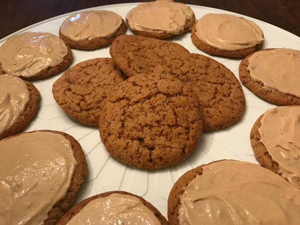 Servings: 24 cookies
Prep/Total Time: 25 minutes (not including time to cool and frost) Ingredients: Cookies
Directions: Cookies
Like this recipe? Check out more of my recipes and meal plans + thousands of others with the Prepear app! |

About MeI am a food loving, activity seeking health coach who resides in Franklin, TN with my husband and two sweet dogs (Lola & Penny). AllergiesI believe everyone should eat balanced and not cut food groups if you don't medically need to. All foods can fit in a healthy diet. Unfortunately, I have to avoid gluten and also limit myself with dairy, so my goal is to provide healthy, gluten-free/dairy-free recipes so EVERYONE can enjoy all foods, even if you do have to cut out certain food groups. My recipes are encouraged for everyone to eat, not just for those with sensitivities/allergies! Most of my recipes can be easily converted by using real dairy and whole-wheat in place of my allergy-free substitutes. SearchLooking for something specific? Everything can be found by category under the "Life" and "Recipes" sections on my website or you can search below. Archives
October 2021
Categories |


 RSS Feed
Location |
|
Elena McCown, LLC Health Coach in Georgetown, TX